Thursday, May 31, 2018

D'Arcy Island, Previous Lepers’ Colony

D'Arcy Island, west side

After exchanging goodbyes with our friends Knut and Christine, we departed Sidney and headed for the scenic and mysterious island of D’Arcy.  Located on the Canadian side of Haro Strait, D’Arcy was one of several islands used to smuggle liquor into the U.S. during Prohibition. 
Plaque Listing 14 Lepers who died on D'Arcy
A more unfortunate piece of history took place between 1894 and 1924 when the island was used as a leper colony, primarily for immigrant Chinese laborers, some of whom lived out the rest of their lives on the island.  A plaque on a rock above the east side cove memorializes 14 Chinese lepers who died on the island, victims of leprosy and prejudice. 
At Anchor off the east side cove, D'Arcy Island
While the small cove on the west side of the island is closest to the ruins, we felt the anchorage on the east side of the island was best; holding was moderate with mixed mud and rock.  We dropped the hook in 16 feet of water and took turns going ashore and at anchor watch.  
Ruins of the Caretaker House
A marked trail leads to the west side of the island, where a few ruins remain, including walls of the caretaker’s house and foundations of buildings that housed the lepers. 
Foundation Ruins
These houses were burned in 1960 but the foundations remain.  In 1961 D’Arcy Island was declared a Provincial Marine Park.  Numerous rocks and reefs surround D’Arcy so boaters need to be cautious and pay close attention to the charts and depth sounder.  Anchorage can appear intimidating but is acceptable in settled weather.  We found the island to be both peaceful and scenic.  I wondered what thoughts lingered here from previous inhabitants – First Nations, Chinese, and later Smugglers.  What might they have been thinking as they gazed across Haro Strait.  Departing D’Arcy Island, we headed across the wind-swept Strait, clearing customs via telephone with our NEXUS BR Number.  Back in home-waters, we anchored in beautiful Westcott Bay on San Juan Island.
Beach at east cove anchorage, D'Arcy Island


Wednesday, May 30, 2018

Time with Friends

Trial Islands Lighthouse with Olympic Mountains backdrop

From Esquimalt we made our way around Gonzales Point past Victoria and the beautiful Trial Islands Lighthouse via Enterprise Channel.  Turning north through Haro Strait, we stopped at Saanichton Bay, located behind James Island south of Sidney, and noted that this large bay would serve as a nice option for anchorage, protected from most winds except northerlies; charted depths of 20-30 feet. 
Princess Anchorage at Portland Island near Sidney
Before arriving at our planned destination of Sidney, we continued a short distance north and circled Portland Island, which offers a couple of cozy anchorages.  Princess Bay, at the south end of the island, has limited anchorage (10-foot depths) that may require a stern tie; drying shoals are at the head of the bay where we saw a sailboat a bit too close!   
Stern-tie Rings are found at Royal Cove, Portland Island
A better option in our opinion is Royal Cove on the north side of the island, which has three stern tie rings along the northeast shoreline; identified in red. 
Red Stern-tie Ring in Royal Cove
Transiting the rocky, narrow channel of John Passage, we arrived in Sidney for the 1 p.m. check-in time, and awaited the arrival of our friends coming from Anacortes.  Knut and Christine, who keep their boat in Anacortes over the winter while residing in South Africa, had planned to meet us in Sidney to spend some time together. 
Enjoying coffee and pastries with friends Christine and Knut
It was so nice to see them again; Knut of German descent, and Christine of Swiss descent, are great company and we enjoy their perspective on life and world travels.  The lovely town of Sidney has lots to offer, including parks, cafes, and boutiques, a great place to spend time with friends. 
Having Fun along the Promonade
We had fun going for coffee at a local bakery and spending an evening together over dinner at a Swiss restaurant in town.  The sun-filled afternoon was the perfect time to walk the promenade south along the waterfront. 
It was a nice break from writing and research; we enjoyed having a few days to just relax.

Sunday, May 27, 2018

Historic Esquimalt Harbour

Anchorage near Cole Island, a Historic Site
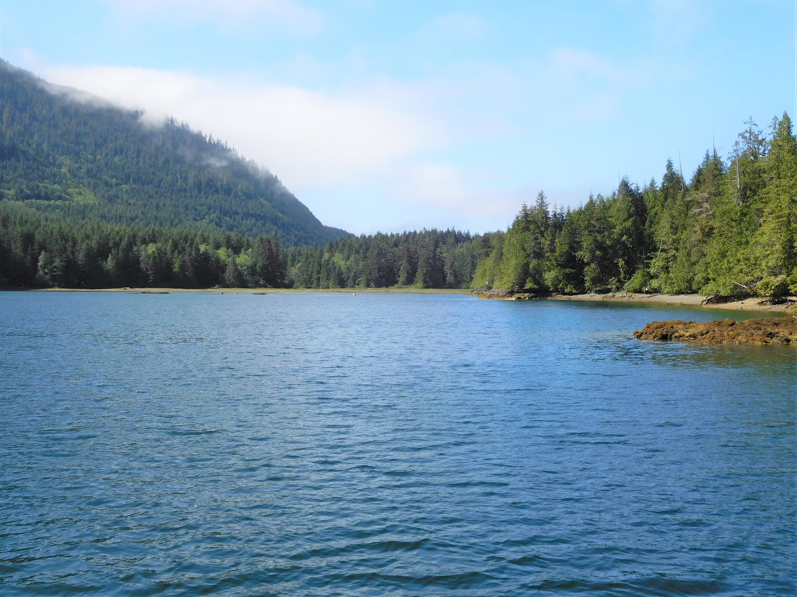
Anchorage in Esquimalt Harbour is located just off Cole Island with beautiful views of the Olympic Mountains.  Some swell makes its way into the harbour, but it’s a small price to pay for the opportunity to visit some significant historic sites. 
1860 Fisgard Lighthouse marks the entrance to Esquimalt Harbour
The Fisgard Lighthouse, a National Historic Site, marks the entrance to Esquimalt Harbour.  Built between 1859 and 1860, Fisgard was Canada’s first lighthouse on the west coast.  At the time, Vancouver Island was not yet part of Canada, and the British Royal Navy’s Pacific Squadron had established themselves at Esquimalt Harbour.  Local brick yards and quarries supplied materials for the construction of the lighthouse; the lens and lamp apparatus came from England with the first keeper, George Davies in 1859. 
The cast-iron spiral staircase in the tower was made in sections in San Francisco.  Around 1897, permanent steel shutters were added to the landward side of the lantern room after cracks in the windows appeared, caused by the concussion from 6-inch guns fired from the newly built Fort Rodd Hill, located near the lighthouse. 
Fisgard Lighthouse is below Fort Rodd Hill
The lighthouse is still operational today and was automated in 1929.  In the early 1940’s, the acetylene lamp in the tower was replaced by a battery-powered electric light.  We visited the lighthouse by dinghy, anchoring off one of several beaches near the lighthouse.  The Fisgard Lighthouse is open to the public from 10 a.m. to 5 p.m., June through October, along with the nearby Fort Rodd Hill National Historic Site.  A small fee is collected from a Park Ranger, or you can pay at the entrance to the Rodd Hill grounds.  Two floors of the lighthouse display photos, artifacts, and provide historic background. 
Gun Emplacement at Fort Rodd Hill
Gun emplacements, magazines, defensive walls, and military houses can be seen at Fort Rodd Hill.  The Fort was built to defend Victoria and the British Naval Base. 
Guns overlooked the Strait of Juan de Fuca
Three hundred British Troops arrived in Esquimalt Harbour in 1893 and construction of the batteries began in 1895.  Six-inch breech-loading artillery guns were installed, tested, and fired. 
Underground Magazine at Fort Rodd Hill
Additional batteries were designed for smaller, quick-firing guns. 
Defensive Walls, Fort Rodd Hill
The Royal Garrison Artillery departed in May of 1906, the last of British troops stationed in Canada. 
Dinghy Dock at Cole Island
Our next stop was Cole Island, where we tied-up to the public float intended for dinghies.  Accessible only by small boat or dinghy, not many people visit the island. 
1859 Storage Buildings on Cole Island
It was here that the Royal Navy established an ammunition depot in 1859, adding more structures as time went on.  Five of the original sixteen structures remain on this small island consisting of storage structures and powder magazines. 
Powder Magazines, Cole Island
We found being alone on the island was both peaceful and haunting. 
If you love history, you may want to add Esquimalt Harbour to your list of planned stops.     

Saturday, May 26, 2018

Finding “Swiftsure”

Leaving Port San Juan in the morning, headed for the Strait of Juan de Fuca

A morning departure from Port Renfrew promised a beautiful day with good visibility and gentle rolling seas of 4-5 feet. 
Race Rocks Lighthouse near the east end in Strait of Juan de Fuca
Traveling with the current, we gained an additional 3 knots of speed and made good time heading eastward. 
AIS shows numerous boats headed our way and crossing the commericial traffic lanes (our boat shown in green)
As we neared Victoria, an unusual number of AIS (Automatic Identification System) targets appeared on our chart plotter.  We soon realized it was the Swiftsure International Yacht Race that had departed from Victoria, making their way westward along the Strait of Juan de Fuca. 
Small Class Sailboat headed along the shore
First held in 1930, Swiftsure is the largest competitive sailing race on the West Coast of North America.  Various classes of sailboats participate and the race is organized with a handicap system so all entrants have an equal competitive chance. 
The race also serves as a qualifying event for the Vic Maui International held in July, a race from Victoria to Hawaii.  The Swiftsure includes six groups which leave at 10-minute intervals from Clover Point; 441 boats entered to race in this year’s event, explaining the large number of sailboats that crossed our path. 
A Larger Class Sailboat
The Swiftsure includes both a Long Course and an Inshore Course.  During the short course, or Inshore course, yachts sail west toward William Head before turning at their mark and making their way eastward to the finish line at Cadboro Bay by late afternoon. 
Long Course yachts make their way to Race Passage toward the west and sail through the night, reaching various turning marks located in U.S. waters before racing back to Victoria.  It’s a challenging race with constantly changing winds, tides, and current. 
The Strait of Juan de Fuca is such a large body of water, that we had no problem avoiding the numerous sailboats, which at that time were going against the current. 
Our AIS showed speed over ground for the larger class sailboats (large sails) crossing the Strait at 8 knots, while the smaller sailboats along the shore were showing speed over ground at 5-6 knots.  It was great fun to watch their course line and tactics.  We arrived at our anchorage in Esquimalt Harbour around 3 p.m.  It had been a nice day with good weather and the added bonus of seeing “Swiftsure” participants in action.       

Friday, May 25, 2018

Discoveries at Port Renfrew

Thursday was our weather window for departing Barkley Sound to continue back south along the west coast of Vancouver Island.  Quartering seas were 7-8 feet at an acceptable 11 seconds, the upper limit for us to be “comfortable.”  As we neared Port San Juan near the entrance to the Strait of Juan de Fuca, seas diminished slightly. 
The new Bridgemans Grill at Pacific Gateway Marina is scheduled to open June 1, 2018
On this return trip south, we once again chose Pacific Gateway Marina in Port Renfrew for moorage.  We were pleased to see that repairs to their docks had been completed, and that the new Bridgemans Grill is scheduled to open June 1st. 
120 Steps lead up the hill from Pacific Gateway Marina
Having arrived in the afternoon, we used the time to hike the stairs (120 steps with switchbacks) that lead to the road above. 
The Coastal Kitchen Cafe has indoor and outdoor seating
Left at the top of the stairs is Tomi’s Home Cooking Café; and a short walk to the right brings you to the Coastal Kitchen Café, which serves breakfast all day from 8 a.m. to 4 p.m.  Further down the road from the Coastal Kitchen Café’ are the Port Renfrew Community Docks, scheduled to be placed in the water on June 1st for the summer season. 
Adorable vacation cottages on the pier at Port Renfrew's seasonal community docks
This area is very inviting with adorable cottages along the pier (Wild Renfrew Seaside Cottages), a gift shop, and the historic Renfrew Hotel which has an attractive Pub serving local craft beer. 
The Historic Port Renfrew Hotel & Pub

We were amazed at the development that is taking place in Port Renfrew.  New condominiums overlooking the harbour are currently for sale, and we saw a new housing development under construction. 
New housing developments are taking place in Port Renfrew
Port Renfrew has a small grocery store northeast of Pacific Gateway Marina near the original town site.  We could tell that the season had picked up with visitors coming from Ladysmith, Duncan, and Victoria to enjoy a summer's vacation. 
Pacific Gateway Marina seen from the top of the stairs
Boaters should be aware that walking along the road to access the grocery store and restaurants above the marina can be disconcerting; the road has no shoulders to speak of and traffic moves swiftly, caution is advised.  
The original village site of Port Renfrew
The nearby West Coast Trail is for serious hikers and runs between Port Renfrew and Bamfield; most hikers complete the trail in 6-7 days.  Hundreds of people hike the trail each season, permits are required as well as a Parks Canada Pass.  Permit applications usually open sometime in early January, and spaces fill quickly for the upcoming summer season.  The rugged West Coast Trail is a combination of forested trails, beach crossings, swing bridges, steep ladder accesses, and cable-cart crossings over creeks and ravines; it's not for the timid or inexperienced.  Designated camping sites and pit toilets are shown on the trail map.  The trail was originally built to facilitate rescuing survivors of shipwrecks; survivors could find shelter in huts along the trail.  We counted 28 ship wreck sites depicted on the trail map.  
Hikers at the West Coast Trail Access in Port San Juan along Gordon River
Entrance and exit points are located at Pachena Bay (Bamfield), Gordon River (Port San Juan), and Nitinaht Lake.  A skiff in Port San Juan takes hikers to the trail head. 
The Parks Office for the West Coast Trail in Port San Juan
On our second day in Port Renfrew, we took the dinghy up Gordon River located at the northeast corner of Port San Juan to visit the West Coast Trail Parks Office.  A dock for dinghies and small boats is located along the bank and is within walking distance of the Parks Office. 
Entering the Gordon River Bar (Pacific Gateway Marina in distance)
Getting across the river bar in the dinghy turned out to be a thrilling ride; we were prepared to take the waves at the appropriate angle, wore rain gear and life jackets.  The trip back was equally exciting, with stronger winds and higher waves.  Waves came crashing over the sides of the dinghy and we had to run the bilge pump.  Back on board Got d' Fever, we hung up our rain gear and had a hot cup of tea. 

Tuesday, May 22, 2018

The Francis Barkley


After a pleasant conversation in the morning with members of the Port Alberni Yacht Club, stationed at beautiful Robbers Passage, we motored across Trevor Channel to investigate Poett Nook. 
Poett Nook has plenty of room to anchor 
Not a nook, but a spacious bay with a narrow entrance, Poett’s Nook has excellent protection from all winds with perfect anchoring depths of 25-35 feet.  The west end of the bay is cordoned-off with a series of floats and buoys connected by lines, but there is still plenty of room to anchor in the bay. 
Poett Nook Marina has ample side-tie for larger boats
Poett Nook Marina is located at the northeast end of the bay and offers numerous slips for sport fishing boats and has ample side-tie for larger boats.  The marina has a convenience store, gas dock, and is a popular stop for RV camping as well as sport fishing.
Exiting Poett Nook into Trevor Channel
As we made our way back out the narrow opening into Trevor Channel, we saw the Francis Barkley making her run to Bamfield. 
M/V Francis Barkley making her run to Bamfield
We, too, were on our way to Bamfield which gave us the opportunity to take some photos of the ship in action, making her deliveries of mail, cargo, and people.  Managed under the company name of Lady Rose Marine Services, the Francis Barkley can accommodate up to 100 passengers with ample indoor seating. 
Kayak rentals are available at Sechart Lodge
Kayaks and canoes can be rented through Lady Rose Marine Services; rental equipment is available at the Sechart Lodge in the Pinkerton Islands, one of the scheduled stops.  The Francis Barkley also makes stops in the Broken Island Group.  The company’s namesake ship, the MV Lady Rose (built in the 1930’s) operated in Alberni Inlet from 1969 to 2008. The MV Francis Barkley, built in Norway in the 1950’s, crossed the Atlantic, transited the Panama Canal, and motored up the west coast to Port Alberni.  The Francis Barkley makes scheduled stops at Kildonan (Uhucklesit Bay), Sechart (Pinkerton Islands), Haggard Cove (Native village), Bamfield, and Ucluelet. 
The Francis Barkley, delivering people and cargo at Bamfield
Upon our arrival in Bamfield, it was evident that the busy season had begun.  The Francis Barkley had brought supplies and visitors, a seaplane had just landed, the Coast Guard were practicing maneuvers, and the water taxi was busy providing transportation between West Bamfield and East Bamfield.  When we approached the West Bamfield Public Dock, we discovered “reserved” signs had been posted on the dock and learned that a “NW Explorations” flotilla would be coming in later that afternoon.  A resident boater at the public dock was kind enough to call the adjacent Bamfield Lodge, who gave us permission to tie-up to their float. 
Guest Dock at Bamfield Lodge
Though not widely advertised, the Bamfield Lodge has space for about two or three boats on their dock directly in front of the lodge.  Moorage is accepted on a space available basis or when the public docks are full.  The moorage rate is slightly more than that charged at the public docks. 
"NW Explorations" flotilla at West Bamfield Public Docks
As it turned out, we met many of the flotilla participants and we were invited by the Pemberton’s, operators of the charter flotilla business, to join them for happy hour; of course, all the boats had a copy of the 2018 Waggoner Cruising Guide.                      
Bamfield Water Taxi
 
The Bamfield Post Office along the West Bamfield Boardwalk
The Boardwalk along West Bamfield